
May 1971 · Vol. 5 No. 6
May 1971 Magazine (Vol. 5 No. 6)
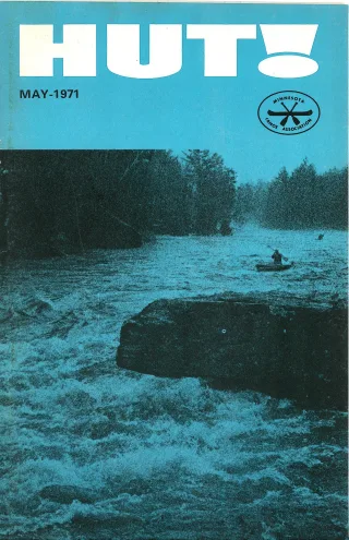
Magazine · 36 pages
Search this issue
May 1971 Magazine (Vol. 5 No. 6)
Captured text — scan page 29
Automatically captured text may contain recognition errors. Compare it with the original scan.
sensations. We shuddered and slid forward. The
water was filled with rock debris, and I could Rathbu n a nd J ohns
hear Charlie laughing hysterically in the stern.
We shot through, hit slow water, and I Start Organizing River
looked back. Satan’s Rock was gone! No 7
dangerous currents. No graveyard for canoes.
Just a gentle, quick slip through a narrow part Trails Resea rch Tea m
of the river. Ahead at the landing, I saw the A new feature in HUT!, to be called the
Volkswagen and trailer. As we pulled in, Charlie «River of the Month,” is being planned through
filled me in. the efforts of the newly organized River Trails
“Figured it out a couple of weeks ago. The Research Team (nicknamed RT2) under the
mass of the canoe and the size of therock and —_ joint leadership of Larry Johns and Bill Rath-
my old high school algebra book. And I was _ bun. This series, tentatively scheduled to begin
pretty sure we could smash our way through in the fall, will comprehensively describe cruis-
it.” . . ing and whitewater rivers of the Upper Mid-
Even though I had left my fingerprints in west, emphasizing those of Minnesota and Wis-
the gunnels from this white-knuckle experience, egnsin. Ultimate plans include republication
Charlie had been right. of the articles in a single volume as a Western
Whitewater canoeists, take note. On your Great Lakes river guide.
map of the River Styx, cross out Devil’s Drop. Of special interest to RT2 are canoeable .
Charlie has renamed it “Angel’s Slide”. rivers for which there are no published guides, ’
7 az as well as those for which only sketchy or mis-
7. 5 OOg Trip Into the leading guides have been published. The fol-
lowing items will be considered for each selec-
4 7, tion:
Qu etl co-Sup én 1 or 1. A map, supplemented with descriptions
af of access road, put-in, take-outs and camp-
Region Each Summer | sis
2. Obstacles (dams, downed timber, exces-
sive snags, barbed wire, portages).
. Average gradient per section.
. Flow rates or gauge heights, if available,
correlated with estimates of difficulty
throughout the season.
5. Average actual running time per section.
6. Rapids description, and rating suggested
Canoe camping has noticeably increased in
the past five years, by at least one-third. Ap- 3
proximately 40,000 people enter the canoe coun- 4
try from Ely, the main gateway, between May 1
and October 31 each year. The figure includes
those who enter the Quetico Park of Ontario
as well. There are three other less traveled
gateways to the canoe country: Crane Lake,
: . . tes.
Sawbill Lake, and the Gunflint Trail. Perhaps 7 es of historical interest regarding’
75,000 persons experience a canoe trip into “the river!
the Quetico-Superior each summer, through all
gateways.
This is spread out over five months and a
large territory, so it isn’t as overwhelming
as it may seem. Except for the first day’s route
where an overlap occurs of persons coming and
going, the region is in no sense overcrowded.
Families generally take the easier trips with
shorter portages, or go in part way to set up
a base camp, ranging out from there on daily
exploratory side trips. The average canoe trip
lasts 7 days. cipate in the exploration of one or more rivers.
Motors are banned from about half of the tpformation may be sent to Bill Rathbun, 1907
canoeable country in the United States, but pyeasant Street. St. Paul 55113.
are not yet banned in Quetico Park.
The canoe country will need enlargement j
within the next few years, and both the Quetico becomes necessary. Logging within the area is
Park and Boundary Waters Canoe Area have actually taking place now, and this must be
room for expansion if the powers-that-be real- stopped to keep the area as natural as possible.
ize the need for expansion before it is too late. Canada has a huge natural canoe area just
Logging, roads, resorts, etc., are springing up northwest of Lake Nipigon which should be de-
on the perimeter, and they will be difficult to' fined and regulated in a way that will “eep it
remove when expansion of canoeing country wild, before roads and resorts are built there.
8. Annual races or other annual events on
the river or bordering towns.
9. Description of the surrounding topog-
raphy, such as cliffs, woods, swamps, and
plains, and also wildlife and flowers which
might be seen.
To be successful in this effort, a relatively
large team of canoeists will be required
throughout each canoeing season. Members are
invited to participate either by submitting
suggestions for appropriate rivers, or to parti-
HUT! — MAY 1971 13
Article contents & approved summaries (0)
No article summaries are available for this view.