
May 1973 · Volume/issue not printed or unknown
May 1973 Magazine
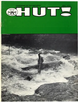
Magazine · 24 pages
Search this issue
May 1973 Magazine
Captured text — scan page 11
Automatically captured text may contain recognition errors. Compare it with the original scan.
in the last 15 miles. river here, but only two rapids are worth Just around the bend from the John-
A publication of the Northwest Wis- remembering in my opinion: Hall Bridge son Bridge is the major rapids on the
consin Canoe Trails Inc., entitled “Canoe- _ Rapids (or Big Joe) and Little Joe Rapids. Brule, the May Ledges. This is a series of
ing the Wild Rivers of Northwestern Wis- Hall Bridge Rapids is just that — a bridge two to three foot high falls named after
consin,” divides the Brule up into four with 2 rock faces in the river. The river the Skid May cabin on the shore here.*
easy day trips of from 7 to 10 hours each. makes an abrupt right and then left turn as There is no doubt when you are nearing
I will follow this format in describing the it goes under the bridge. The trick is to these rapids. They are around a left bend
Brule; however, most paddlers of my ac- stay away from each rock wall as the river in the river. First you can hear them.
quaintance do not canoe the whole river, _ tries to dash you into it — actually nottoo Then the river seems to drop off the edge
but drive up on a weekend and choose’ difficult. The final rapids is Little Joe. of the world. We always stop to look
parts which are a challenge to their ability. There is a natural channel near the right these over, and there is a well-worn portage
The town of Brule is 29 miles east of side of the river. The hazard in this is its trail on the right shore. The first ledge
Superior, Wisconsin on Highway 2, which quick rocky drop, but it is over ina flash looks formidable, but is quite easy if you
is an easy three hour drive from the Twin and easy to do, with a quiet pool at the go through the notch near the right shore.
Cities. Several campgrounds, gas stations bottom. A portage trail exists to the right The second ledge has a natural chute just
and a canoe rental shop are in or near the for the very timid. A riffle or two brings left of center. The third ledge is the one
town of Brule, so it is a convenient place you to the Brule State Forest Campground to watch. I have been tricked into going
to meet. I will attempt to describe the which is an excellent place to camp right too close to the left shore more times
‘Brule from source to mouth, relyingon the _ on the river. It’s also a good place for kids than I care to count, and each time
previously mentioned publication for in- to wade in the river. Just a little further dumped, of course. The fourth ledge re-
formation where experience is lacking. on is the official landing in the town of quires some muscle to stay on the left
The put-in place for the first 10 milesis Brule. Total time is about 7 hours for this side of the river to avoid the boulder at
at a Fishermans’ landing on County Road _ trip. the bottom. After that there is only a
“P” which crosses the west fork of the The next day trip listed in the Wiscon- boulder field to contend with, in which
Brule. This is just north of Upper Lake St. sin publication goes from the town of you may even have to get out to guide
Croix and the town of Solon Springs. This Brule to the N.P. Johnson Bridge — adis- your canoe. It never seems to matter
portion of the river resembles a creek, tance of ten miles. The first seven miles] which side of the island you go on — both
winds through a bog and may be very have never paddled. The description is are often shallow. Not too much further
shallow at times. I have never paddled that the river here is slow, deep, windy, On are two more minor ledges that can be
this stretch, but friends who have, groan and flat with no rapids. This character taken anywhere. Rapids from here on are
when it’s suggested, so perhaps this isnot abruptly changes as the river approaches nameless, numerous, and easy, relatively
one of the most exciting portions of the the Copper Range Campground — which speaking. There is little opportunity to
Brule River. Take-out is at Stones Bridge _is about three miles south of the Johnson rest, however. Highway 13 bridge and
on County Highway “S”’. This trip is re- Bridge and can be easily reached on_ parking area is our usual take-out point if
ported to be about 10 hours long. County Road “H” out of the town of we are not going all the way to the lake.
The next section of river goes from Brule. We have often camped here and From the Johnson Bridge to Highway 13
Stones Bridge to Highway 2inthe town of nearly always start from here for the best usually takes about three hours, depending
Brule, is 12 miles long, and served as my Whitewater paddling on the Brule. The real on how much time is spent at the ledges.
first introduction to whitewater canoeing rapids start here and continue almost with- From Highway 13 to Lake Superior is not
in an open canoe. The shoreline is beauti- Out let-up for the next fifteen miles. Most a dull trip. There are riffles, rapids, and
fully wooded all the way, with only afew of these rapids are unnamed. The major even a minor ledge falls about half-way,
cabins to break the trees. The water isfast | rapids before the Johnson Bridge is called called Shale Falls. Shale Falls has an ob-
at times, but the river starts you out with the Lenroot Ledges. This is a series of low vious chute on the extreme left. The water
only a few riffles and builds your confi- ledges that come on you by surprise as_ in this stretch is fast and the river makes
dence so that you can easily take the few you follow a left bend in the river. The many abrupt turns until it comes to the
rapids towards the end. The first third of | natural current seems to follow an ex- Lamprey Weir about a mile from Lake
this trip has no riffles at all. The river treme zig-zag course over these ledges and Superior. Here the river widens, slows
calmly brings you to an area called Cedar _ that is the most successful route to follow down, and straightens out as it flows into
Island Estate, which is several large, mag- if you are quick. In Jow enough water the Lake Superior. A sandbar is formed at the
nificent cabins, finished in cedar shingles, Canoe usually gets stranded on one of the mouth, which is suitable for camping, and
setting among the trees, on the shore and Shallow rock ledges and simply must be a parking area is provided on the right
islands of the Brule. Reportedly, three pulled back into the main current. In high shore. This last stretch of river has never
presidents have stayed here in the last water it is hard to find one single channel taken more than three hours — usually
century. After this the riffles begin — all and it is probably best not to run these less. The total time from Johnson Bridge
of which have names — none of which] ledges at that time. There is a portage to Lake Superior is five to six hours. The
ever remember. Half way,orabout 4hours _ trail on the right bank. Take-out is at the total time from Copper Range Camp-
from the beginning of this trip, is a place parking area on the left shore below the ground to Highway 13 is four to five
called Big Lake. This is simply a shallow, Johnson Bridge. The complete trip from hours plus two hours more to go all the
widened part of the river through which town to bridge should last nine hours. The way out to Lake Superior.
you may have to walk your canoe. A few __last three miles, however, from the camp- The Brule River, with its diverse levels
more riffles and a few more wider partsof ground to the bridge, only takes about an __ of paddling difficulty, primitively wooded
the river bring you to Winnebijou(County hour. We often make a lunch stop here at shores, and excellent fishing, lures many
Road “‘B”) which is a possible take out this bridge, on the right shore. This is people to its banks, and holds the place of
spot for those who don’t wish to try the also a good put-in spot for the fourth day “favorite river” for at least one person
easy rapids ahead. trip written up in the Wisconsin publica- that I know.
The final portion of this trip, from tion — from the N.P. Johnson Bridge to
Winnebijou to the town of Brule,isafun Lake Superior — a distance of thirteen
stretch that takes about an hour to run. miles. Twelve of these thirteen miles are
and is often used as a warm up for the constant rapids. The river is never still . .
much harder ledges ahead. There are until it comes within a mile of Lake Su- eee eno ar te of pers
several little rapids and many bends tothe _ perior itself. origin in the summer of 1972.
HUT! MAY, 1973 9
Article contents & approved summaries (0)
No article summaries are available for this view.