
August 1981 · Volume/issue not printed or unknown
August 1981 Magazine
Magazine · 12 pages
Search this issue
For the full-resolution original, use Open PDF above. Your browser handles PDF zoom and navigation.
Searchable text for scan page 8
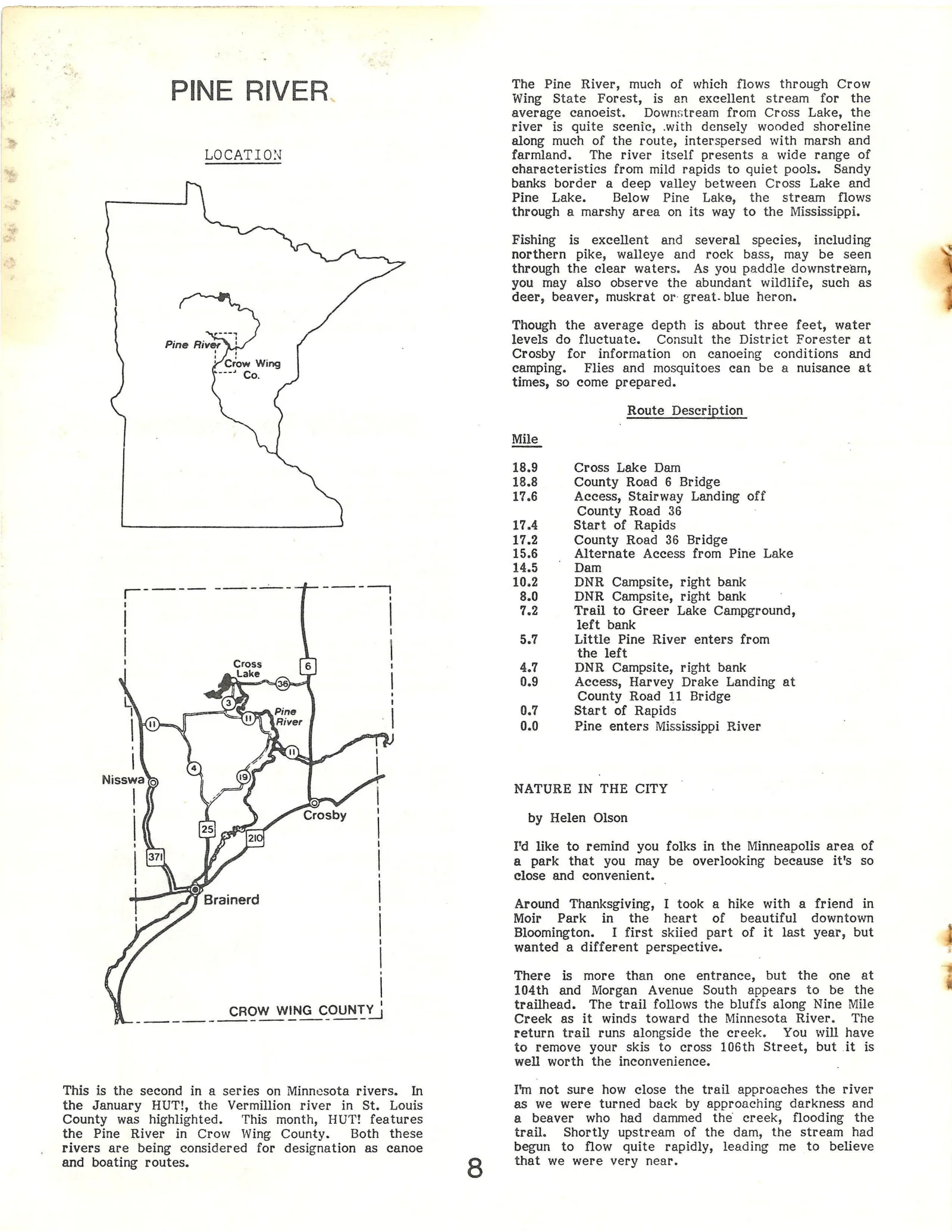
|. bs The Pine River, much of which flows through Crow
Ee PINE RIVER. Wing State Forest, is an excellent stream for the
average canoeist. Downstream from Cross Lake, the
river is quite scenic, with densely wooded shoreline
Es along much of the route, interspersed with marsh and
LOCATION farmland. The river itself presents a wide range of
“6 characteristics from mild rapids to quiet pools. Sandy
banks border a deep valley between Cross Lake and
Pine Lake. Below Pine Lake, the stream flows
through a marshy area on its way to the Mississippi.
3
3 Fishing is excellent and several species, including
northern pike, walleye and rock bass, may be seen
through the clear waters. As you paddle downstream,
you may also observe the abundant wildlife, such as
deer, beaver, muskrat or: great-blue heron.
Though the average depth is about three feet, water
levels do fluctuate. Consult the District Forester at
Crosby for information on canoeing conditions and
camping. Flies and mosquitoes can be a nuisance at
times, so come prepared.
Route Description
Mile
18.9 Cross Lake Dam
18.8 County Road 6 Bridge
17.6 Access, Stairway Landing off
County Road 36
17.4 Start of Rapids
17.2 County Road 36 Bridge
15.6 Alternate Access from Pine Lake
14.5 Dam
10.2 DNR Campsite, right bank
8.0 DNR Campsite, right bank
7.2 Trail to Greer Lake Campground,
left bank
5.7 Little Pine River enters from
the left
4.7 DNR Campsite, right bank
0.9 Access, Harvey Drake Landing at
County Road 11 Bridge
0.7 Start of Rapids
0.0 Pine enters Mississippi River
NATURE IN THE CITY
by Helen Olson
I'd like to remind you folks in the Minneapolis area of
a park that you may be overlooking because it's so
close and convenient. —
Around Thanksgiving, I took a hike with a friend in
Moir Park in the heart of beautiful downtown
Bloomington. I first skiied part of it last year, but d
wanted a different perspective. :
There is more than one entrance, but the one at ;
104th and Morgan Avenue South appears to be the
trailhead. The trail follows the bluffs along Nine Mile
Creek as it winds toward the Minnesota River. The
return trail runs alongside the creek. You will have
to remove your skis to cross 106th Street, but it is
well worth the inconvenience.
This is the second in a series on Minnesota rivers. In I'm not sure how close the trail approaches the river
the January HUT!, the Vermillion river in St. Louis as we were turned back by approaching darkness and
County was highlighted. This month, HUT! features a@ beaver who had dammed the creek, flooding the
the Pine River in Crow Wing County. Both these trail. Shortly upstream of the dam, the stream had
rivers are being considered for designation as canoe begun to flow quite rapidly, leading me to believe
and boating routes. 8 that we were very near.
Article contents & approved summaries (0)
No article summaries are available for this view.