
March 1984 · Vol. 20 No. 3
March 1984 Magazine (Vol. 20 No. 3)
Magazine · 20 pages
Search this issue
For the full-resolution original, use Open PDF above. Your browser handles PDF zoom and navigation.
Searchable text for scan page 9
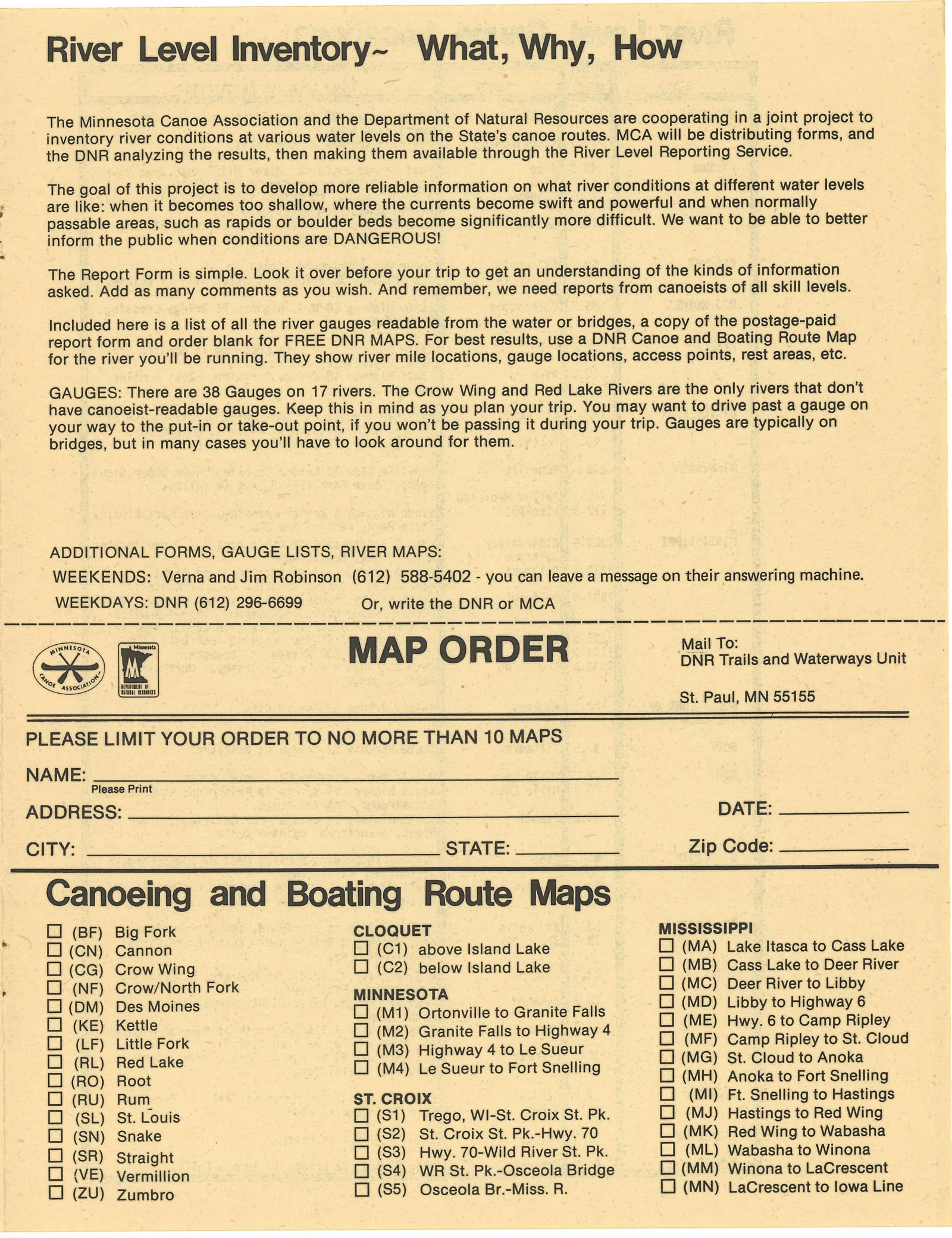
River Level Inventory~ What, Why, How
The Minnesota Canoe Association and the Department of Natural Resources are cooperating in a joint project to
~ inventory river conditions at various water levels on the State’s canoe routes. MCA will be distributing forms, and
the DNR analyzing the results, then making them available through the River Level Reporting Service.
The goal of this project is to develop more reliable information on what river conditions at different water levels
are like: when it becomes too shallow, where the currents become swift and powerful and when normally
passable areas, such as rapids or boulder beds become significantly more difficult. We want to be able to better
inform the public when conditions are DANGEROUS!
The Report Form is simple. Look it over before your trip to get an understanding of the kinds of information
asked. Add as many comments as you wish. And remember, we need reports from canoeists of all skill levels.
Included here is a list of all the river gauges readable from the water or bridges, a copy of the postage-paid
report form and order blank for FREE DNR MAPS. For best results, use a DNR Canoe and Boating Route Map
for the river you'll be running. They show river mile locations, gauge locations, access points, rest areas, etc.
GAUGES: There are 38 Gauges on 17 rivers. The Crow Wing and Red Lake Rivers are the only rivers that don’t
have canoeist-readable gauges. Keep this in mind as you plan your trip. You may want to drive past a gauge on
your way to the put-in or take-out point, if you won’t be passing it during your trip. Gauges are typically on
bridges, but in many cases you'll have to look around for them.
ADDITIONAL FORMS, GAUGE LISTS, RIVER MAPS:
WEEKENDS: Verna and Jim Robinson (612) 588-5402 - you can leave a message on their answering machine.
WEEKDAYS: DNR (612) 296-6699 Or, write the DNR or MCA
MAP O R D ER ean als and Waterways Unit
St. Paul, MN 55155
PLEASE LIMIT YOUR ORDER TO NO MORE THAN 10 MAPS
NAME:
Please Print
ADDRESS: DATE:
CITY: STATE: _ Zip Code:
Canoeing and Boating Route Maps
: (1 (BF) Big Fork CLOQUET MISSISSIPPI
[1 (CN) Cannon 1 (C1) above Island Lake C0 (MA) Lake Itasca to Cass Lake
LJ (CG) Crow Wing C1 (C2) below Island Lake : (MB) Cass Lake to Deer River
(1 (NF) Crow/North Fork (MC) Deer River to Libby
>
[J (DM) Des Moines MINNESOTA , : (1 (MD) Libby to Highway 6
[1 (M1) Ortonville to Granite Falls :
CL] (KE) Kettle j [CJ (ME) Hwy. 6 to Camp Ripley
o C1 (M2) Granite Falls to Highway 4
(LF) Little Fork : (1) (MF) Camp Ripley to St. Cloud
CJ (M3) Highway 4 to Le Sueur
[1] (RL) Red Lake Cl (M4) Le Sueur to Fort Snelling [J (MG) St. Cloud to Anoka
[1] (RO) Root CJ (MH) Anoka to Fort Snelling
O) (RU) Rum ST. CROIX O (MI) Ft. Snelling to Hastings
1 (SL) St. Louis LJ (S1) Trego, WI-St. Croix St. Pk. [J (MJ) Hastings to Red Wing
[LJ (SN) Snake OJ (S2) St. Croix St. Pk.-Hwy. 70 (1 (MK) Red Wing to Wabasha
C] (SR) Straight LC] (S3) Hwy. 70-Wild River St. Pk. [1 (ML) Wabasha to Winona
1 (VE) Vermillion (1 (S4) WR St. Pk.-Osceola Bridge (J (MM) Winona to LaCrescent
O (ZU) Zumbro (1 ($5) Osceola Br.-Miss. R. (1 (MN) LaCrescent to lowa Line
Article contents & approved summaries (0)
No article summaries are available for this view.