
May 1973 · Volume/issue not printed or unknown
May 1973 Magazine
Magazine · 24 pages
Search this issue
For the full-resolution original, use Open PDF above. Your browser handles PDF zoom and navigation.
Searchable text for scan page 5
system of Wild and Scenic Rivers, the val-
ley will be preserved forthe enjoyment of |
‘ generations to come.
The river above Taylors Falls is still |
-largely untrammeled and appears much
the same today as it did to the early In- |
dians. Wildlife abounds and the Bald Eagle
and Sturgeon still inhabit the skies and
waters of this section of the valley. The
Namekagon, wild and lovely tributary to
the St. Croix, bears the Chippewa name of
that rare fish.
The valley is peaceful now, but it was :
not always so. During early geological an L-
times this section of North America was
the scene of numerous diastrophic dis-
turbances, or massive upheavals. Moun-
tains rose and were worn away. Volcanoes _.
spewed their fiery wastes, and earthquakes
distorted the surface of the land.
About 600 million years ago, during r
the Keweenawan period of the Proterozoic SF
era of geological time, extensive lava flows
were extruded from faults in the earth’s
crust and covered the land to depths, in
some places, in excess of 30,000 feet.
These flows cooled to form the basalt
bedrock which has since been carved by
the river. to form the spectacular Dalles at _
Taylors Falls, and which underlies the SA
numerous rapids of the upper valley. These AS
flows marked the end of igneous activity
in the midwest.
During the following 530 million years,
the North American continent was washed
by alternately advancing and retreating
seas. The rocks which underlie much of
the area were laid down as sediments
under these seas. : ;
The composition of these various sedi-
mentary layers thus formed was determined
by the conditions existing at the time of
their deposition, and fossils preserved in
these rocks tell us much about the devel-
opment of life on earth. Several of these
layers,.or formations, are beautifully ex-
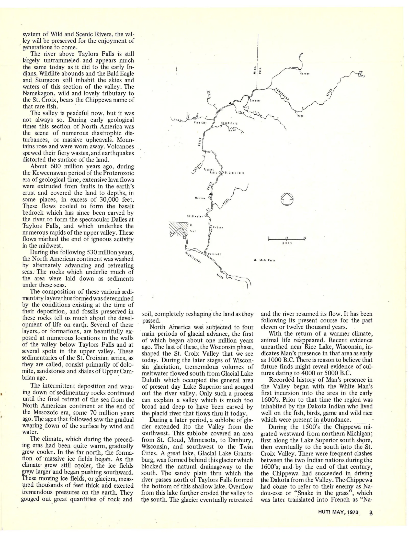
Pine City Crantsburg
Mar
Stillwater
.
N] st.
\ Paul
Hudson
MILES
& State Parks
soil, completely reshaping the landasthey and the river resumed its flow. It has been
passed. following its present course for the past
North America was subjected to four eleven or twelve thousand years.
e RES main periods of glacial advance, the first With the return of a warmer climate,
posed at numerous locations in the walls oF which began about one million years animal life reappeared. Recent evidence
of the valley below Taylors Falls and at ago. The last of these, the Wisconsin phase, unearthed near Rice Lake, Wisconsin, in-
several spots in the upper valley. These shaped the St. Croix Valley that we see dicates Man’s presence in that area as early
sedimentaries ofthe St. Croixian series, as today. During the later stages of Wiscon- as 1000 B.C. There is reason to believe that
they are called, consist primarily of dolo- gin glaciation, trememdous volumes of future finds might reveal evidence of cul-
mite, sandstones and shales of UpperCam- — meltwater flowed south from Glacial Lake _ tures dating to 4000 or 5000 B.C.
brian age. Duluth which occupied the general area Recorded history of Man’s presence in
The intermittent deposition and wear- of present day Lake Superior and gouged the Valley began with the White Man’s
ing down of sedimentary rocks continued out the river valley. Only such a process first incursion into the area in the early
until the final retreat of the sea from the can explain a valley which is much too 1600’s. Prior to that time the region was
North American continent at the end of broad and deep to have been carved by inhabited by the Dakota Indian who lived
the Mesozoic era, some 70 million years _ the placid river that flows thru it today. well on the fish, birds, game and wild rice
ago. The ages that followed saw the gradual During a later period, a sublobe of gla- which were present in abundance. __
wearing down of the surface by wind and cier extended. ito the Valley from the During the 1500’s the Chippewa mi-
water. southwest. This sublobe covered an area grated westward from northern Michigan;
‘ The climate, which during the preced- from St. Cloud, Minnesota, to Danbury, first along the Lake Superior south shore,
ing eras had been quite warm, gradually Wisconsin, and southwest to the Twin then eventually to the south into the St.
grew cooler. In the’ far north, the forma- Cities. A great lake, Glacial Lake Grants- Croix Valley. There were frequent clashes
tion of massive ice fields began. As the burg, was formed behind this glacier which between the two Indian nations during the
climate grew still cooler, the ice fields blocked the natural drainageway to the 1600's; and by the end of that century,
grew larger and began pushing southward. south. The sandy plain thru which the the Chippewa had succeeded in driving
These moving ice fields, or glaciers, meas- river passes north of Taylors Falls formed the Dakota from the Valley. The: Chippewa
ured thousands of feet thick and exerted the bottom of this shallow lake. Overflow had come to refer to their enemy as Na-
tremendous pressures on the earth, They from this lake further eroded the valley to dou-esse or “Snake in the grass”, which
gouged out great quantities of rock and the south. The glacier eventually retreated was later translated into French as “‘Na-
HUT! MAY, 1973. 3
Article contents & approved summaries (0)
No article summaries are available for this view.